RAN STATION 9 MYRTLETOWN
INDICATOR LOOP STATION AND PHOTO-ELECTRIC BEAM
![]()

RAN Station 9 Myrtletown
Plan: - NAA
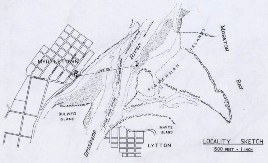
RAN Station 9 Myrtletown Locality Sketch
Plan:- NAA
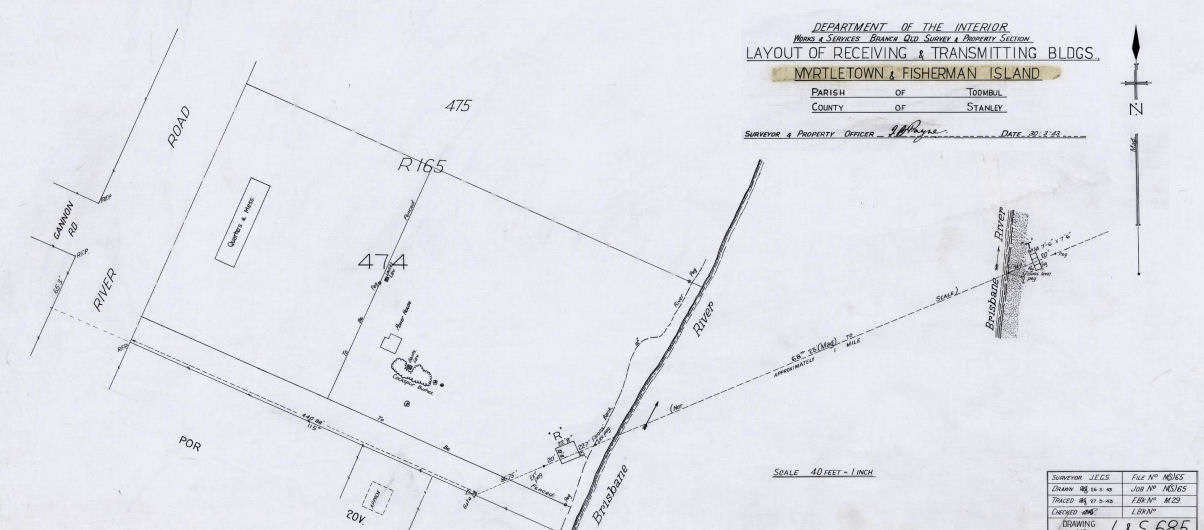
Layout of RAN 9 Myrtletown
On 3 February 1943 it was decided to lay another Indicator Loop from Myrtletown to Fisherman Island along with a Photo Electric Beam across the Brisbane River as part of the seaward defences for Moreton Bay.
The indicator loop was completed by HMAS Bangalow across the entrance of the Brisbane River between RAN Station 9 Myrtletown and Fisherman Island on 2 March 1943. The indicator loop was used to detect the presence of any submerged Japanese submarines entering the Brisbane River.
RAN Station 9 Myrtletown Indicator Loop Station commenced operation on 8 January 1944.
The PE Beam installation was finished on 28 September 1943. It transmitted a light beam from Fisherman Island to RAN 9 Myrtletown. This was used to detect the presence of surface vessels entering the Brisbane River. Not far upstream RAN 8, an Anti-submarine Boom Defence Facility, was established between Lytton near Fort Lytton and the northern bank of the Brisbane River. HMAS Kinchela was permanently moored in the Brisbane River as part of this Boom Defence system. If a submerged submarine was detected by RAN Station 9 Myrtletown, a signal would then have been sent to RAN Station 8 Lytton Boom Defence Facility to raise the boom cable.
In the picture above, the concrete building at the left of the photograph is the one closest to the Brisbane River. This is the Control Building where the loop cables were terminated and all of the instrumentation was located. The concrete building to the right hand side of the above photograph contained the generator.
The larger concrete foundation in the center of the above photograph was the location of the living and eating quarters for the officers and ordinary ranks with the officers located at the left hand end of the building. The mess room area was located between the two living quarters.
There were two small toilet buildings, one either side of the living quarters. They can be seen in the above photograph.
A US Searchlight Battery was stationed about 400 metres to the north east of RAN Station 9.
It was decided on 1 June 1945 to remove the Indicator Loop in the Brisbane River. HMAS Limosa removed this loop on 2 June 1945.
The photo-electric station on Fisherman Island was unfortunately demolished during the development of the new Port of Brisbane at Fisherman Island.
There was another RAN Shore Station known as RAN Station 10 Controlled Mining Base somewhere near Pinkenba.

Photo:- Peter Dunn
The Generator Building looking towards the mouth of the Brisbane River

Photo:- Peter Dunn
Entrance to the Generator Building barred up the council to keep the vandals out

Photo:- Peter Dunn
A cable leaving the Generator Building heading towards the Control Building

Photo:- Peter Dunn
The Generator Building looking upstream

Photo:- Peter Dunn
The Control Building adjacent to the Brisbane River looking upstream

Photo:- Peter Dunn
The Control Building adjacent to the Brisbane
River
looking towards the mouth of the Brisbane River

Photo:- Peter Dunn
The Control Building adjacent to the Brisbane
River
looking towards the mouth of the Brisbane River

Photo:- Peter Dunn
The Control Building adjacent to the Brisbane River looking upstream
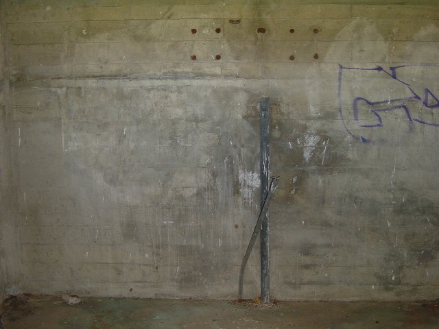
Photo:- Peter Dunn
Inside the Control Building

Photo:- Peter Dunn
Inside the Control Building

Photo:- Peter Dunn
Remains of a barge or similar, in mud flats adjacent to the Control Building
Update:- Joyce MacDonald was talking to an
elderly gentleman in the
park in October 2006. He told her that the remains
are of an
old steamer
called 'Koopa' - it was a passenger service from North
Quay to Bribie Island.

Photo:- Peter Dunn
Remains of a another barge or similar, in the
mud
flats adjacent to the Control Building. See above.
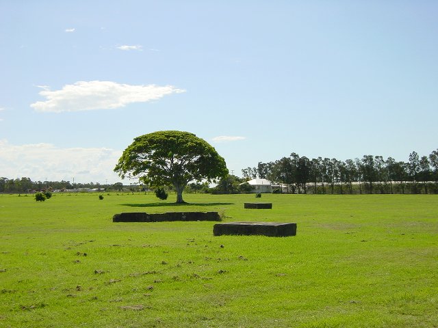
Photo:- Peter Dunn
The slabs of the living quarters and the two toilet buildings

Photo:- Peter Dunn
Toilet building foundation

Photo:- Peter Dunn
Steel plate on the top of the toilet building foundation

Photo:- Peter Dunn
A large concrete beam about 100 metres
downstream from RAN 9. If you
look closely at the right hand side of the photograph you
will see an
large International Passenger Jet taking off from Brisbane Airport.
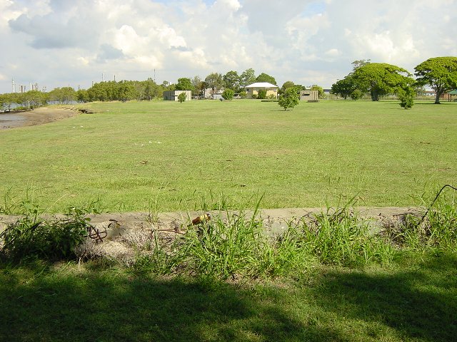
Photo:- Peter Dunn
A large concrete beam about 100 metres
downstream from RAN 9.
You can just see the two concrete bunkers in the distance.
REFERENCE BOOKS
"Fortress Brisbane - A Guide to
historic fixed defence sites of Brisbane and the Moreton Bay Islands"
by D.W. Spethman and R.G. Miller
ACKNOWLEDGEMENTS
I'd like to thank Joyce MacDonald and Barry Needham for their assistance with this web page.
Can anyone help me with more information?
"Australia @ War" WWII Research Products

|
|
© Peter Dunn 2015 |
Please
e-mail me |

This page first produced 26 April 2001
This page last updated 21 January 2024

