BATHURST ISLAND AIRFIELD
BATHURST ISLAND, NT
IN AUSTRALIA DURING WWII
![]()
The WWII Bathurst Island Airfield was a mostly all-over grass airfield. The RAAF guide states that there were three runways. You can see a partial runway at the top left in the 1940 photo below. And the 1941 photo below seems to show the other two partial runways. This WWII airfield is almost 2 kilometers from the current civilian airfield which was built in the 1970s. The main township now covers the site of the WWII airfield.
The RAAF Aerodrome Guide has the following entry for Bathurst Island ELG:-
Dimensions 5100ft NE-SW Natural surface
2700ft E-W Natural surface
2190ft NW-SE Natural surfaceRemarks Mission & 2 RAAF buildings to N. Cliffs
25ft to the S. Trees on W. side. Wireless
mast (60ft) N. side of W. end of E-W run.
Fuel, flares available. U.S. wet conditions
Adjacent to Mission Station
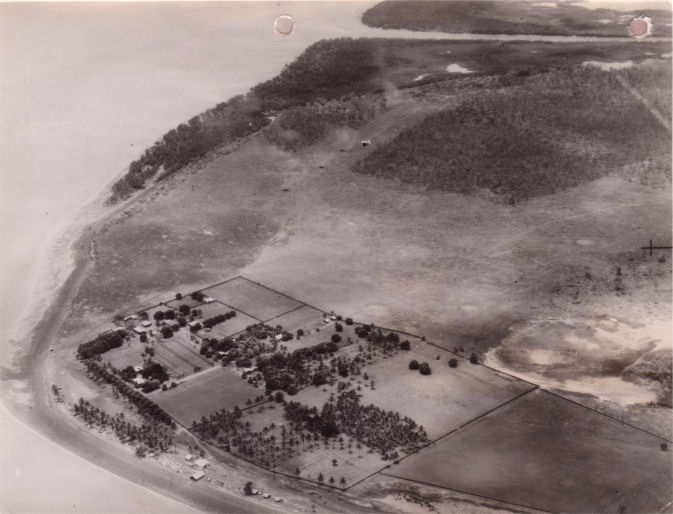
Photo:- via Barry J. Goodall
Bathurst Island Airfield on 4 December 1940 (PA02902, 14 Sqn)
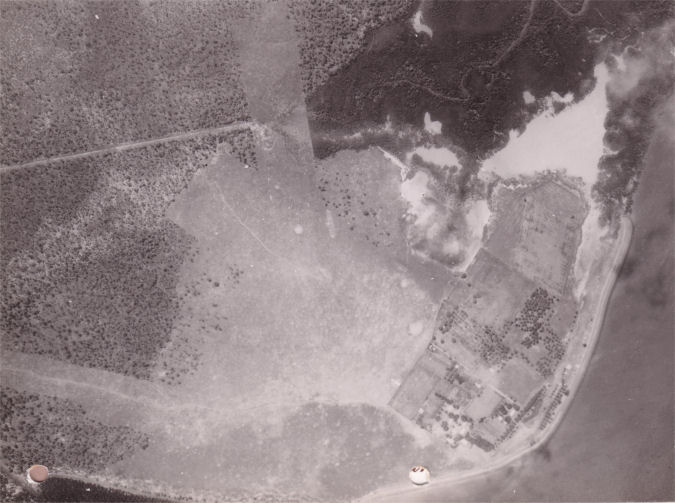
Photo:- via Barry J. Goodall
Bathurst Island Airfield on 8 January 1941 (VB3184-6291, 13 Sqn)

Photo:- Google Earth
Approximate location of the WWII Bathurst Island Airfield
Photo:- via Barry J. Goodall
Bathurst Island Airfield on 30 July 1941 (GA356, 6 Sqn)
ACKNOWLEDGEMENTS
I'd like to thank Daniel Leahy for his assistance with this airfield.
Can anyone help me with more information?
"Australia @ War" WWII Research Products

|
|
© Peter Dunn 2015 |
Please
e-mail me |

This page first produced 17 March 2021
This page last updated 17 March 2021

